
Shop, Warehouse & Office on 2.03 Acres – Bryant Rd
8351 Bryant, Silsbee, TX 77656 View map
- Price
- $305,000
- Price / SF
- $70.60
- Building
- 4,320 SF
- Lot
- 2.03 AC
- Type
- Industrial/Flex
Overview
8351 Bryant in Silsbee is a versatile commercial property set on two acres, offering ample space for a variety of business opportunities. The property features a 750 SF renovated office area with two well-sized office spaces, a bathroom, and a kitchen, providing a comfortable workspace. Additionally, there’s a spacious 3,570 sq. ft. attached warehouse equipped with a bathroom, five bay doors that measure 14'x14' each, ideal for storage, logistics, or light industrial use. The acreage would make a great lay down yard or would be great for expansion. With its large lot, multiple access points, and flexible layout, this property is well-suited for businesses requiring both office and warehouse facilities, from automotive services to distribution hubs and much more. There is a container for storage and a metal storage shed that stays with the property. Call an agent for more inforamtion.
Property details
- Property type
- Industrial/Flex
- Transaction
- For Sale
- Status
- Available
- Sale price
- $305,000
- Building size
- 4,320 SF
- Lot size
- 2.03 acres
- Frontage
- County Road
- Parking
- 21 - 30 Cars On Site Paved Area
- Clear height
- 9 - 12 Ft., 16 - 20 Ft.
- County
- Hardin
- Primary use
- Industrial, Office, Prof. Space, Retail Store, Service Station, Warehouse, Wholesale Store
- Construction
- Metal
- Utilities
- City Water, Electric, Septic System, Telephone
- Restrooms
- Two
Location
8351 Bryant, Silsbee, TX 77656
Site due diligence
- Site analysed
- 0.49 ac appraisal parcel · Hardin County (CAD account 32552)
The listing is 2.03 ac, so it likely includes adjoining parcels; figures below cover the parcel under the listing pin. - Flood zone
- Zone X · 100%
Outside the 1% annual-chance floodplain (SFHA)
FEMA NFHL (effective) · FIRM 48199C - Wetlands
- None mapped on the site
- Elevation & slope
- 68–71 ft (relief 2.4 ft) · typical slope 0.5%, steepest 2.5%
32 USGS 3DEP samples, ~26 ft apart - City / ETJ
- Unincorporated Hardin County
Nearest city limits: Silsbee, 1.19 mi – likely outside any ETJ
Estimated from Tex. Loc. Gov't Code §42.021 distances; ETJs can differ by agreement or release. Confirm with the city. - Zoning
- None – Texas counties do not zone unincorporated land (check deed restrictions)
- Water & sewer
- Water: T & W WATER SERVICE COMPANY (CCN 12892), NORTH HARDIN WSC (CCN 11267)
Sewer: No certificated provider mapped (septic or nearby system)
PUC certificated service areas (CCN) and TCEQ districts; a CCN shows who may serve, not that a line reaches the site. - Power
- Entergy Texas, Inc. (800) 368-3749
- Gas
- Natural-gas pipeline 2,559 ft away (Energy Transfer Company, 8.63")
RRC-permitted pipeline; local distribution mains are not public – ask the gas utility. - Opportunity Zone
- No
- School district
- Silsbee Independent School District
- Road frontage
- ≈ 95 ft on Bryant Rd
Parcel edges alongside TxDOT road centrelines; measure on a survey.
Listing states: County Road - Traffic count
- 11,421 vehicles/day on FM 92 (2025 AADT, 0.22 mi away)
- Drive-time population
- 5 min: 1,976 · 10 min: 10,201 · 15 min: 12,412
Residents of block groups centred inside each drive-time area (Census ACS 5-year 2020-2024). Show on map
Reference only; verify with the appraisal district, FEMA and the city. Checked Nov 2, 2026 from public GIS: FEMA NFHL, USFWS National Wetlands Inventory, USGS 3DEP, TxDOT (city limits, roadways, AADT), PUC of Texas (CCN), TCEQ, HIFLD, Railroad Commission of Texas, HUD/Treasury Opportunity Zones, U.S. Census TIGERweb, TxGIO StratMap parcels and city zoning GIS.
Run the numbers
General estimates, not financial, tax or legal advice. Figures are rounded and depend on your inputs; confirm with your lender, CPA or qualified intermediary. All calculators →
Nearby national & regional brands
Within 1 mile (2)
 Dollar General0.6 mi
 Valero1.0 mi
1–3 miles (13)
 Brookshire Brothers2.7 mi
 Aaron's2.8 mi
 Walgreens2.8 mi
 CVS Pharmacy2.9 mi
 Domino's1.6 mi
 Dairy Queen1.8 mi
 McDonald's2.8 mi
 Jack in the Box2.9 mi
 Taco Bell2.9 mi
 Subway2.9 mi
 Waffle House2.9 mi
 Pizza Hut2.9 mi
 Exxon1.1 mi
3–5 miles (7)
 Walmart3.5 mi
 KFC3.0 mi
 Whataburger3.0 mi
 Sonic3.1 mi
 AutoZone3.1 mi
 Phillips 663.1 mi
 Chevron4.0 mi
Brand locations © OpenStreetMap contributors (ODbL), straight-line distance. Logos via Wikimedia Commons. OpenStreetMap coverage is incomplete; verify on site. Logos and names are trademarks of their owners, shown only to identify nearby businesses; no affiliation or endorsement is implied.
Crime around this property
Block-level crime estimates by DoorProfit (reported incidents where the city publishes them, modelled from public statistics elsewhere). For general reference only.
Demographics
Printable 1-page reportHousehold income
1 mile 3 miles 5 miles · Per capita income: $32,400 / $29,200 / $29,800
Age & sex (3-mile ring)
Average household size: 2.18 / 2.69 / 2.64 (1 / 3 / 5 mi)
Education (adults 25+)
No diploma High school Some college / assoc. Bachelor's Graduate
Housing
Owner occupied Renter occupied Vacant
- Housing units
- 741 / 4,681 / 7,052
- Median home value*
- $71.0K / $117K / $133K
- Median gross rent*
- $1,140 / $1,050 / $1,020
Daytime population vs residents
Residents Daytime population
Employees per resident (3 mi): 0.19 · Employed residents: 684 / 4,143 / 6,207
Top employment sectors (3-mile ring, jobs located here)
Population trend
Census 2010 and 2020 counts; rate = average annual change. Current ACS estimate: 1,471 / 10,542 / 15,732 (1 / 3 / 5 mi).
Commute & labour (1 / 3 / 5 mi)
- Mean travel time to work
- 31.5 min / 30.7 min / 31.1 min
- Drive alone
- 87% / 83% / 82%
- Carpool
- 11% / 11% / 11%
- Work from home
- 2% / 3% / 3%
- Unemployment (ACS, residents)
- 0.2% / 4.6% / 5.6%
- Hardin County unemployment (BLS, September 2026, prelim.)
- 4.5%
Traffic counts (nearest TxDOT stations)
| Road | Vehicles / day | Year | Distance |
|---|---|---|---|
| Fm0092 | 11,421 | 2025 | 0.2 mi |
Source: U.S. Census Bureau, ACS 5-year estimates (2020-2024); 2010 and 2020 Census counts; LEHD LODES workplace jobs (2023); BLS LAUS; TxDOT AADT. Rings are straight-line radii; figures are estimates. Block-group values are apportioned to rings by their share of 2020 Census block population; medians and *home value/rent are approximations. Daytime population = jobs located in the ring + residents not employed.
Brochure
More properties from Brand Realty
View all properties →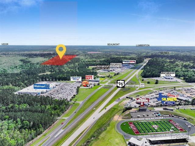
90.42-Acre Timber & Recreational Tract – Gentry Dr, Silsbee
2000 Block Gentry Dr., Silsbee, TX
Land · 90.42 AC
Sale price: $375,000
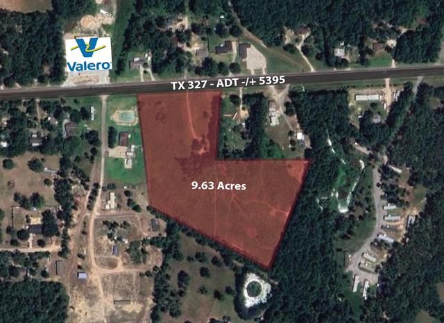
9.63 Acres with Highway Frontage – TX-327, Silsbee
2000 Block TX 327, Silsbee, TX
Land · 9.63 AC
Sale price: $350,000
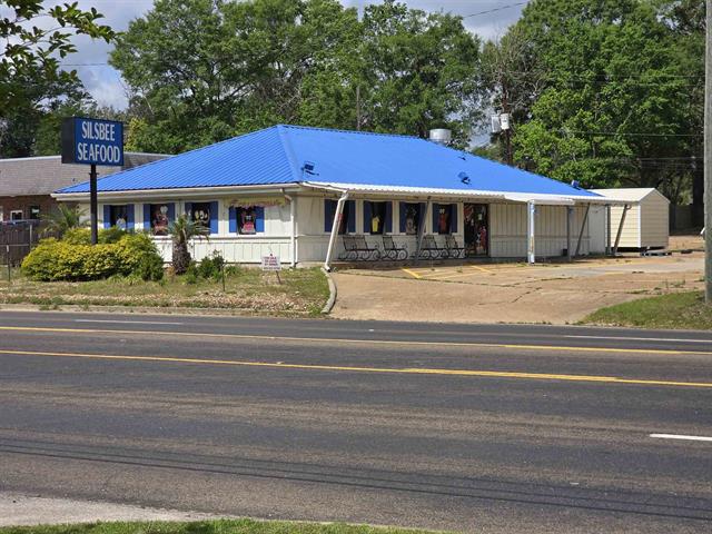
Former Restaurant with Drive-Thru – Hwy 96 S
720 S Hwy 96, Silsbee, TX
Retail · 2,424 SF · 0.6 AC
Sale price: $500,000 Lease rate: $4,250/mo
Information is believed reliable but is not guaranteed and should be independently verified. Price, terms and availability may change without notice.